

ASH carried out a Landscape and Visual Impact Assessment of the two-turbine M1 J18 development near Daventry
In 2011 ASH was commissioned by Savills on behalf of Airvolution Energy, to carry out Landscape and Visual Assessment in support of a two-turbine development in Northamptonshire.
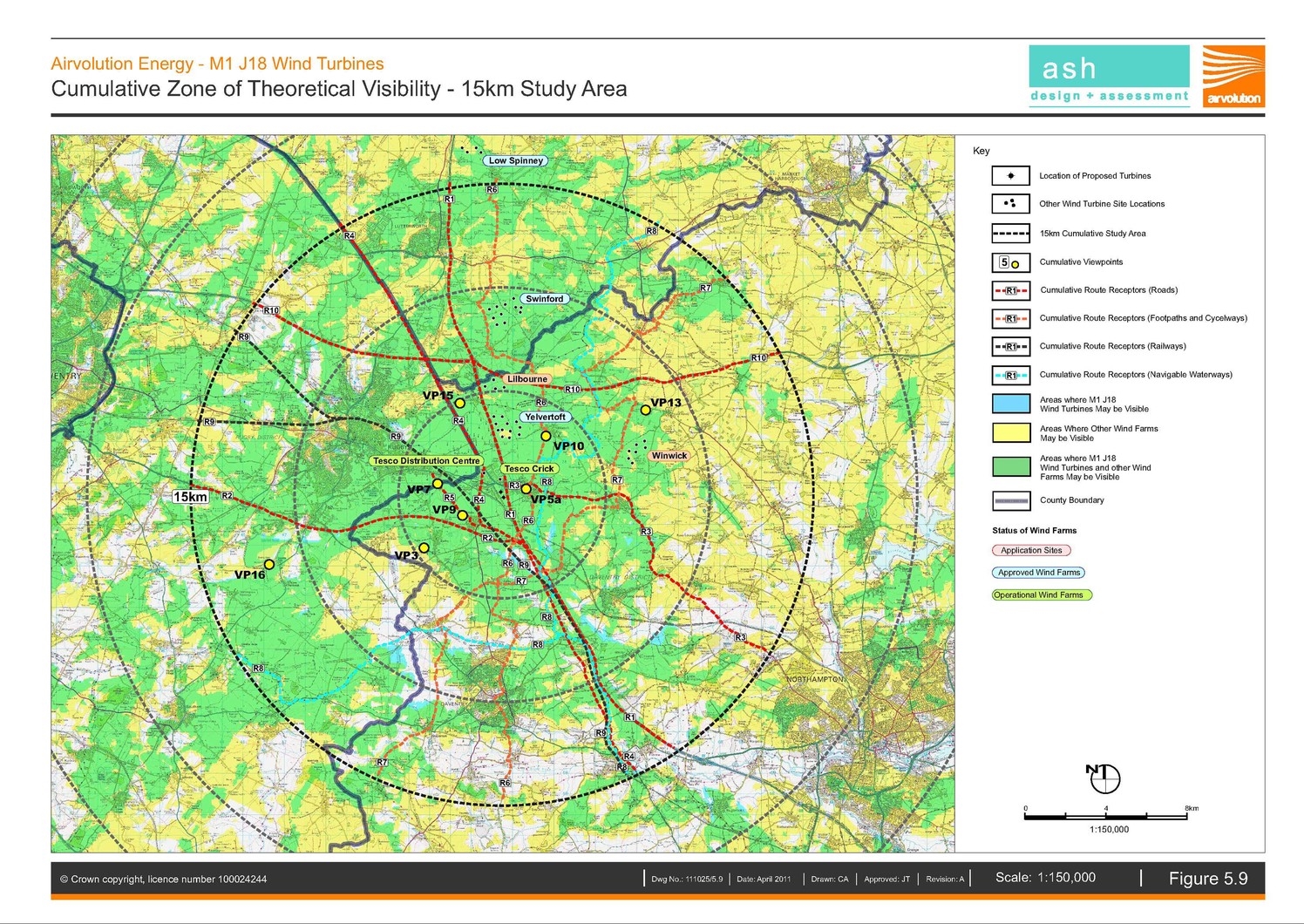
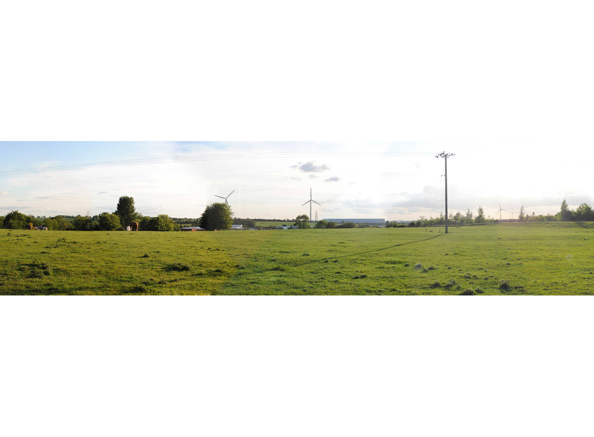
Generating 4 mW, the two M1 J18 wind turbines are situated within Daventry district, approximately 3km from the Warwickshire town of Rugby. The nearest settlements with visual receptors are Crick (less then 1km to the east), Kilsby (1.75km to the south-east) and Yelvertoft (3.5km to the north-east).
The Daventry International Railfreight Terminal (DIRFT) and associated distribution centres are located within less than 500m to the north, east and west.

Key Tasks
Landscape and visual impact assessment
Cumulative landscape and visual impact assessment
Photography
Photomontages
Residential amenity study
Stakeholder consultation
What we did
Sitting within a web of communication lines, the turbine site is bordered by the M1 (to the east), the Northampton loop of the west coast mainline railway to the south and west, the M45 to the south, and the A5 to both the west and north. The historical/recreation routes of the Grand Union and Oxford canals pass to the east and west respectively, at approximately 2-3km's distance.
Within the immediate surroundings of the site, is development relating to communication infrastructure and distribution and warehousing services, as well as manufacturing and other industries founded on the historical convergence of the main transport links from London to Birmingham, via the Watford Gap. This forms a key location with a distinctive landscape character. However, within just a few kilometres, the character becomes altogether more rural, which serves to emphasise and reinforce the centralisation of infrastructure at the DIRFT-Crick nodal point around the M1 at junction 18.
Set within the broad landscape setting of the Northamptonshire, the proposed site occupies the lower northern, though poorly-defined, scarp slopes adjoining the lower land of the Feldon and the Leicestershire Vales. Generally, this is an area of mixed farming, which also includes a number of country houses (some with connections to the English Civil War) and gardens and designed landscapes. However, as already described, the DIRFT-Crick area is a distinctly more urbanised entity than its surrounding countryside.
Planning Permission was granted in 2012 and the turbines were constructed in 2014. They are now operational.
Find out more
We’re always happy to answer your questions. If you’d like to find out more about the services we can offer for your project, you can email us on info@ashglasgow.com or call 0141 227 3388.